Wencke Rudi
Pre-Amble
The Queen’s Bush Settlement was located within the area of Wellington County, the ancestral territory belonging to the Mississaugas and the Six Nations, and was one of the largest Black settlements in Southwestern Ontario. With over 1,500 free and formerly enslaved Black people, the Black settlement was formed in the area from Waterloo County to Lake Huron, what is currently known as Mapleton. While the research that follows focuses on Black life in the settlement, it is important to acknowledge that Black settlement is itself part of colonial histories of settlement on Indigenous lands. And yet, , there is a historical and ongoing relationship of respect and solidarity between Black and Indigenous peoples as both have been subjected to the violent and disruptive colonial processes of dispossession and displacement.
While researching the history of the Queen’s Bush Settlement, I sought to bring to life the Black community that was once existed in this location: “What happened, here, at the Queen’s Bush Settlement?” This larger area of Southwestern Ontario is known for narratives of whiteness, maleness, and experiences of “settling” and “pioneering” in traditional colonial terms. The WebMap attempts to answer the “here” aspect of my research question by plotting the Black individuals and families of the settlement onto the geographic space of Ontario. The StoryMap is interested in constructing the “happening” by narrativizing the Black social life that transforms space into place.
I worked with the Elora land document to plot Black settlers and visualise the space of the community. The map became a tool to see the possible routes from church to school, from the mill to homes, and the proximity between the homes of the Black settlers themselves. The WebMap draws attention to these relations by incorporating treaties, city boundaries, and current land values amongst the plotting of Black individuals, families, and households of the Queen’s Bush settlement. The aims of the StoryMap and WebMap are to bring attention to the more complex history of the Waterloo and Wellington Counties by folding in Black heritage, Indigenous presence, and the contributions of women and girls into our understanding of the settlement and colonization of this area.
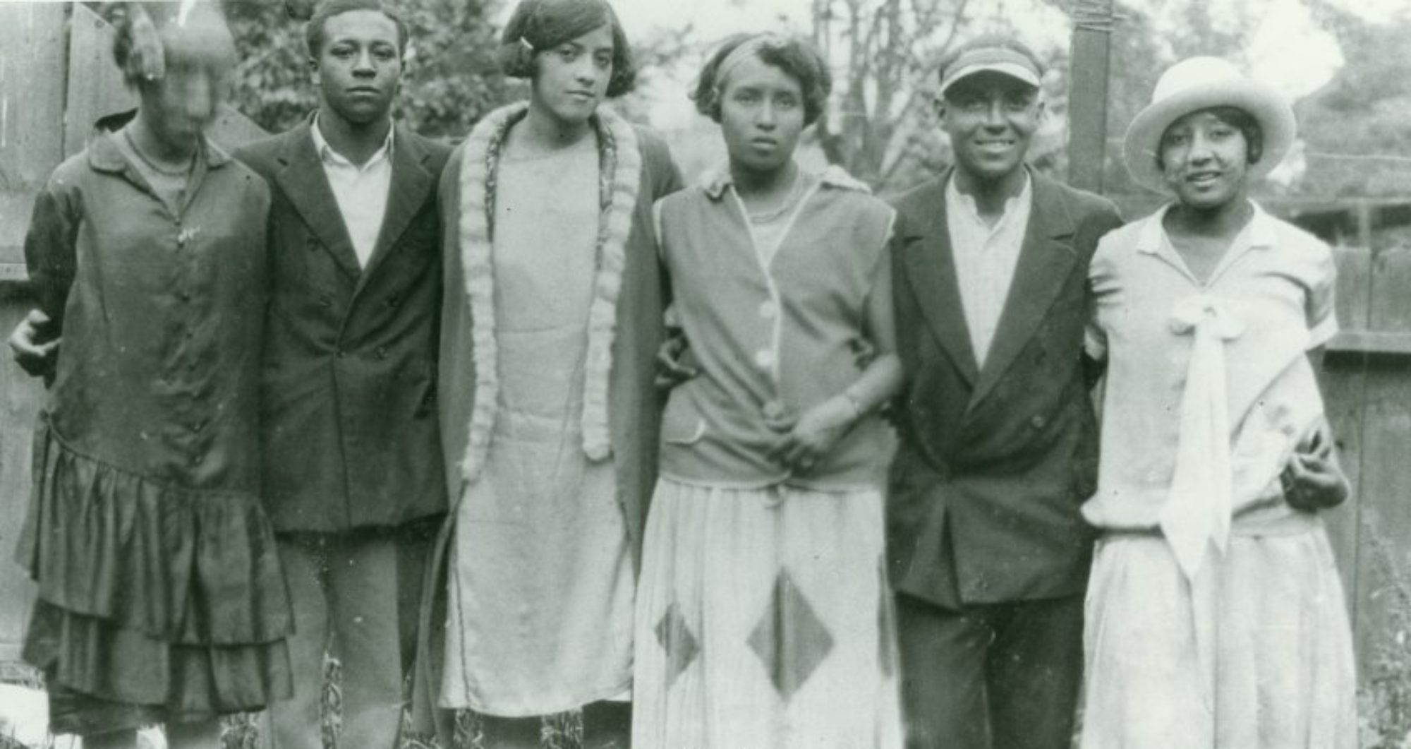
The StoryMap was created from imagining and speculating on Black life in early Canada. I engaging with research on other Black settlements in Southwestern Ontario and relied on images from these settlements as there are no extant images of Queen’s Bush. Employing Saidiya Hartman’s notion of critical fabulation to create “a history of an unrecoverable past…a narrative of what might have been or could have been,” I aimed to “break open” the archival and secondary documents on Queen’s Bush to create “a history written with and against the archive” (“Venus in Two Acts” 12). Narrating Black presence, particularly the lives of Black girls and women, in the geographic space of Wellington County, I contests our understanding of place (wilderness) and nation (Canada) as spaces of white, masculine, individualism by showing the ways Black people and their labour were constitutive to the creation and development of place and nation.
StoryMap
WebMap
How to Use the Map
The WebMap plots the Black individuals and families of the Queen’s Bush settlement, spanning from the settlement’s concentration during 1830-1850, as well as including the descendants who stayed in the area. The plot points are an approximation of where the Black individuals and families would have cleared the land and settled. I encourage those who are using the map to click on the dot to expand the plot point and get more information. Some individuals are listed on the same plot point and are featured by going to the next sheet (arrow in top right corner). I provide the information source of the plot point (LBK is an acronym for Linda Brown-Kubisch, referring to her book, The Queen’s Bush Settlement: Black Pioneers 1839-1865), and encourage people to make connections from the map to the attached Appendix A from LBK, as well as other resources and information available.
As well as space, time was a crucial component to the settlement’s increase and decline. The map is presented alongside a time slider at the bottom, with the dots consistently staying as the map progresses along time. The persistence of the dots over time indicates the purpose of the map. It cannot be taken as an authoritative source of information, but as a project that is presenting an argument about the settlement’s centrality to the development of Wellington County.
Author Biography
Wencke Rudi is a PhD student in the School of English and Theatre Studies at the University of Guelph. She completed the WebMap and StoryMap as part of her Master’s work and is continuing to conduct research focused on Black Canadian history and settlements into her PhD.